Dalaba
Dalaba (Pular : ???????) is a town and sub-prefecture in the Dalaba Prefecture in the Mamou Region of Guinea.
It was once home to a sanatorium, and to Miriam Makeba, who last visited the town in 1988, when she came to see her niece, N'Tombi Makeba, who lived in Miriam's house (a round building dating to the French colonial period, but using the same form as traditional homes in the region) for a number of years in the 1980s. The town is also known for its local strawberries. The town of Dalaba is the highest (in altitude) town in Guinea. It is approximately 200 km by air from the capital Conakry and about 280 km by road. The inhabitants of Dalaba are mostly Fula (Peul; Fulɓe).
The market day in Dalaba is Sunday.
The women of Dalaba dye cotton damask fabric a rich-hued indigo in detailed tie-dyed patterns.
Like the rest of the Futa Djalon region of which it is part, Dalaba's climate is moderated by the altitude. It was a popular retreat area for French during the colonial period largely for that reason. It is said locally that there was snowfall in Dalaba once in the 1930s.
Map - Dalaba
Map


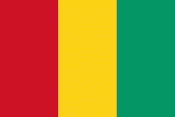
Country - Guinea
 |
 |
| Flag of Guinea | |
Formerly French Guinea, it achieved independence in 1958. It has a history of military coups d'état. After decades of authoritarian rule, in 2010 it held its first democratic election. As it continued to hold multi-party elections, the country continued to face ethnic conflicts, corruption, and abuses by military and police. In 2011, the United States government claimed that torture by security forces and abuse of women and children (including female genital mutilation) were ongoing human rights issues. In 2021, a military faction overthrew president Alpha Condé and suspended the constitution.
Currency / Language
| ISO | Currency | Symbol | Significant figures |
|---|---|---|---|
| GNF | Guinean franc | Fr | 0 |
| ISO | Language |
|---|---|
| FR | French language |